Hurricane Florence becoming dangerous
Published 7:39 pm Tuesday, September 11, 2018

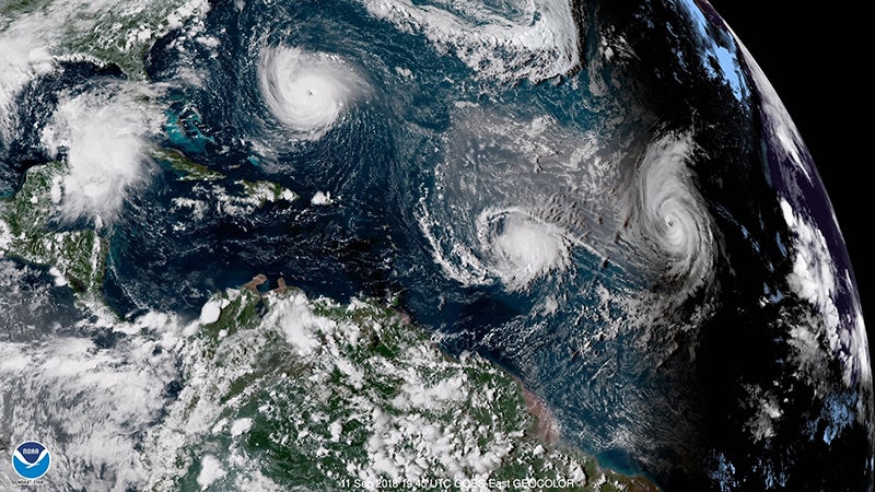
- This satellite image shows Hurricane Florence moving toward the East Coast.
|
Getting your Trinity Audio player ready...
|
WINDSOR
In a bulletin posted at 5 p.m. on Tuesday, the National Hurricane Center stated, “Dangerous Florence expected to bring life-threatening storm surge and rainfall to portions of the Carolinas and Mid-Atlantic.”
Maximum sustained winds increased to nearly 140 mph, still within Category 4 on the Saffir-Simpson Hurricane Wind Scale.
The outlook at www.nhc.noaa.gov stated that the eye of the storm was located by satellite near latitude 27.5 North, longitude 67.1 West. Further, the hurricane is moving toward the west-northwest near 17 mph. A motion toward the west-northwest and northwest is expected through early Thursday.
“Florence is expected to slow down considerably by late Thursday into Friday,” the description continued. “On the forecast track, the center of Florence will move over the southwestern Atlantic Ocean between Bermuda and the Bahamas through Wednesday, and approach the coast of North Carolina or South Carolina in the hurricane warning area on Thursday and Friday.”
Mike Rusnak, a meteorologist at the National Weather Service’s Wakefield station, confirmed that view to the newspaper as early as Monday afternoon, and that remained unchanged by deadline on Tuesday.
“We expect it to make landfall in southeastern North Carolina on Thursday morning, and then kind of slow down, stall and produce a lot of rain.”
Showers and thunderstorms are in the forecast for Friday as well as into Saturday, he said, adding that all this could produce coastal flooding, as well as tropical storm-force winds.
There could be sporadic power outages, though Rusnak pointed out, “It’s hard to say when and where.”
Though the storms could strengthen on Wednesday, some weakening is expected on Thursday. Nonetheless, the NHC outlook re-emphasized that “Florence is forecast to be an extremely dangerous major hurricane through landfall. Hurricane-force winds extend outward up to 60 miles from the center and tropical-storm-force winds extend outward up to 175 miles.”
Stay tuned for updates from Windsor Weekly on the hurricane and related issues.


